Yangon International Airport (Yangon International Airport)
Yangon International Airport is the primary and busiest international airport of Myanmar. The airport is located in Mingaladon, 15 km north of central Yangon. All ten Myanmar carriers and about 30 international airlines operate at Yangon International Airport. The airport is also colloquially known as Mingaladon Airport due to its location.
During World War II, the airfield was called RAF Mingaladon and served as an operating base for fighter aircraft such as:
* No. 60 Squadron RAF from February 1941 to February 1942 flying Bristol Blenheim I
* No. 67 Squadron RAF from October 1941 to March 1942 flying Brewster F2A Buffalo and Hawker Hurricane IIs
* No. 135 Squadron RAF from January–February 1942 flying Hawker Hurricane IIs
* No. 681 Squadron RAF from June to September 1945 flying Supermarine Spitfire
* 3rd Squadron of 1st American Volunteer Group (Flying Tigers) of the Chinese Air Force flying Curtiss P-40s
There was also a Communication Flight of the Burma Volunteer Air Force equipped with Tiger Moths and Westland Lysanders and anti-aircraft support for the airfield was provided by members of the 12th Burma Rifles.
Mingaladon was then used by the Japanese, and Japanese bombers based in Bangkok were moved forward to Mingaladon when there was a full moon. The British at the Wireless Experimental Centre in Delhi were breaking BULBUL the IJA air-to-ground code, and could predict Japanese air raids. On one occasion Allied nightfighters "got the lot and all night we could hear Mingaladon air base calling for its lost children".
Additional units;
| IATA Code | RGN | ICAO Code | VYYY | FAA Code | |
|---|---|---|---|---|---|
| Telephone | Fax | ||||
| Home page |
Map - Yangon International Airport (Yangon International Airport)
Map
Country - Burma
 |
 |
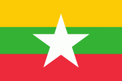
| Flag of Myanmar | |
Early civilisations in the area included the Tibeto-Burman-speaking Pyu city-states in Upper Myanmar and the Mon kingdoms in Lower Myanmar. In the 9th century, the Bamar people entered the upper Irrawaddy valley, and following the establishment of the Pagan Kingdom in the 1050s, the Burmese language, culture, and Theravada Buddhism slowly became dominant in the country. The Pagan Kingdom fell to Mongol invasions, and several warring states emerged. In the 16th century, reunified by the Taungoo dynasty, the country became the largest empire in the history of Southeast Asia for a short period.
Currency / Language
| ISO | Currency | Symbol | Significant figures |
|---|---|---|---|
| MMK | Myanmar kyat | Ks | 2 |
| ISO | Language |
|---|---|
| MY | Burmese language |


